Guidelines for Assessment Reports: Nunavut Mining Regulations
Table of contents
- Introduction
- The assessment report process
- Determining "cost of work"
- Submitting an assessment report
- Writing an assessment report
- Hard copy report submission
- Electronic format report submission
- Content criteria for assessment reports
- Reference list
- Appendices
- Requirements for specific types of report
- Criteria for simplified reports
Introduction
These guidelines are presented as a plain-language summary of the requirements for submitting assessment reports to the Mining Recorder under the Nunavut Mining Regulations (NMR), and to assist report authors in filing reports that are accurate and complete according to the NMR.
This document is to be referred to in conjunction with the amended NMR, which came into force November 1, 2020. It is not intended as a substitute for the regulations.
Mineral tenure licensees who hold rights to one or more mineral claims must perform work in order to retain those rights. This work must be documented in reports which meet the criteria in the NMR and in Schedule 2 of those regulations.
For further information about mineral tenure management in Nunavut, please visit the website of the Nunavut Mining Recorder's Office (MRO).
The term 'assessment report' is used throughout these guidelines to refer to the work reports required by the NMR, as that is the most familiar industry term. 'Assessment report' can be read interchangeably with the term 'report of work' used in the regulations.
The assessment report process
Assessment reports that document work completed on mineral claims located on Crown land are filed with the Mining Recorder for Crown-Indigenous Relations and Northern Affairs Canada (CIRNAC) in Nunavut.
The intent of filing these reports is to assign the cost of the work completed on the mineral claim to fulfill the work requirements set out in the NMR. The reports must be submitted in hard copy or electronic format to the Mining Recorder, along with the relevant information as required in the Nunavut Map Selection system. Generally, a report may only include work done over 12 consecutive months, during the 4 years preceding the day on which the report is submitted to the Mining Recorder (NMR 42(2)).
There are 2 exceptions to this requirement: the initial work report on a claim or claims may include both the first and second year of work (NMR 41(a)), and work which was done on the area of a claim up to 2 years prior to the day on which that claim is recorded in NMS is considered as having been done in the first year after the recording of the claim (NMR 42(3)).
How a report is reviewed
Mineral Resources Division geologists at CIRNAC's Nunavut Regional Office review assessment reports after they have been received from the MRO, within an internal service standard of 90 days for completion of reviews starting from the date the reports are received. If the reviewing geologist finds that there are areas in which a report does not comply with the NMR, they will send a letter to the report's author indicating what revisions are necessary.
The report author then has 120 days from the date of the review letter to submit revisions to the reviewing geologist. On receipt of those revisions, the reviewing geologist will determine if they are sufficient to bring the report into compliance with the NMR.
Report revisions may be accepted via Canada Post, via email (up to a limit of ~10Mb of attachments), or via use of a file sharing service such as Sync. Do not send .zip or other compressed file formats via email as they will be rejected by the mail server, and neither the sender nor the recipient will receive notification of the rejection.
Once the reviewing geologist has assessed the compliance of the report with the NMR requirements and determined the costs of work to be entered into the certificate of work, they will contact the author to indicate the final cost of work that has been approved for that report and reported to the Mining Recorder so the amount can be allocated to the mineral claim(s) being reported on.
The information submitted in these reports serves to justify the expenses being claimed on mineral claims, and is released to the public after a 3 year confidentiality period. This industry-generated geoscience information, when combined with data released through government and academic research, contributes to the geological knowledge of the territory of Nunavut, and informs exploration and investment decisions. Released reports are hosted on NunavutGeoscience.ca.
Determining "cost of work"
For expenditures to qualify as a "cost of work" they must fall into the categories listed in the definition of "work" in the NMR. Please see NMR section 1 (1) for definitions of "cost of work" and "work".
Under that definition, the following expenditures are not considered "work":
- costs for transporting workers or equipment to or from outside Canada
- taxes paid to any level of government
- when submitting a Statement of Expenditures, subtract any applied taxes from the total amount for each expense and indicate on the statement that they have been taken out. For example, "GST has been removed from the total for each expenditure"
- costs related to recording a claim
- legal fees
- administrative costs, including expenses which relate to company operation, day-to-day office expenses, and any other costs not directly connected with work performed on the property
- although some Canadian jurisdictions allow the addition of a "flat rate" percentage of the total expenditures which can be claimed under the category of administrative costs, Nunavut does not
- costs of environmental baseline studies, done in conjunction with geological field work, that exceed 10% of the cost of geological work. It is no longer possible for environmental baseline studies to be credited to their full amount beyond this limit
- "costs of doing business" such as software purchases, office equipment, or employee training
- expenditures to satisfy regulatory requirements and authorizations, such as fees associated with land use permits or water licenses
Please do not include receipts, invoices, or similar documentation with the report as those items will be requested if necessary. Any costs that the reviewing geologist considers excessive in relation to the work being reported on will be subject to further inquiry.
The intent of the NMR is for exploration work to be done on specific mineral claims and for the associated expenditures to be applied to those mineral claims. Costs incurred in support of this exploration work, such as for food, accommodations, and supplies, must be applied proportionately based on the amount of work done on the mineral claims; these costs cannot be allocated globally to all mineral claims on a property. Except in the case of grouping, under section 45 of the NMR, work must be done on a claim in order for costs of work to be applied to it.
In short, just because money is spent on an exploration project in Nunavut does not mean that the full amount spent will be approved as a "cost of work."
Expenditures that do not qualify as "work" under NMR 1 (1) will not be approved. Report authors with questions about whether an expense meets the definition of "work" can contact the Mineral Resources Division at CIRNAC's Nunavut Regional Office by email at: minerauxnu-mineralsnu@rcaanc-cirnac.gc.ca.
Submitting an assessment report
As part of submitting a report to the MRO, the Submit Claims Work function in the Nunavut Map Selection system must be filled out for each report indicating how much and what types of work have been completed on each claim. For reporting on program expenditures, we recommend using this Statement of Expenditures template (MS Excel, 21 KB). The assessment report must include all information necessary to support the expenditures being claimed as a "cost of work," as well as any appendices required for the report, such as maps, raw geophysical data, assay certificates and contractors' reports. Specific criteria for the reports are discussed in the sections below.
Under paragraph 42(4)(b) of the NMR, assessment reports must be signed off by a Qualified Person who is registered with the Northwest Territories and Nunavut Association of Professional Engineers and Geoscientists (NAPEG). Reports of work which have been signed off by Qualified Persons registered in other jurisdictions will not be accepted by the Mining Recorder. Please contact the MRO for more information. Details on registering with the association can be found on the NAPEG website at http://www.napeg.nt.ca.
Simplified assessment reports are required to be signed by the individual who performed or supervised the work. Simplified reports may be submitted under NMR 42 (1), 42 (4), and Part 2 of Schedule 2, (17). These reports deal only with excavation, sampling or the examination of outcrops and surficial deposits, or any combination of these, for which the cost of work is less than $20,000. A a set of guidelines intended for prospectors who plan to prepare simplified reports is available: The Simplified Report: a guide for Nunavut prospectors.
Report submission
Assessment reports must be submitted to the following address:
Attn: Mining Recorder
Nunavut Regional Office
Crown-Indigenous Relations and Northern Affairs Canada
918 Nunavut Drive
Iqaluit, NU X0A 3H0
Report authors with further questions about the submission process may reach the MRO at 867-975-4281, or by email at registraireminierscn-miningrecordersnms@rcaanc-cirnac.gc.ca.
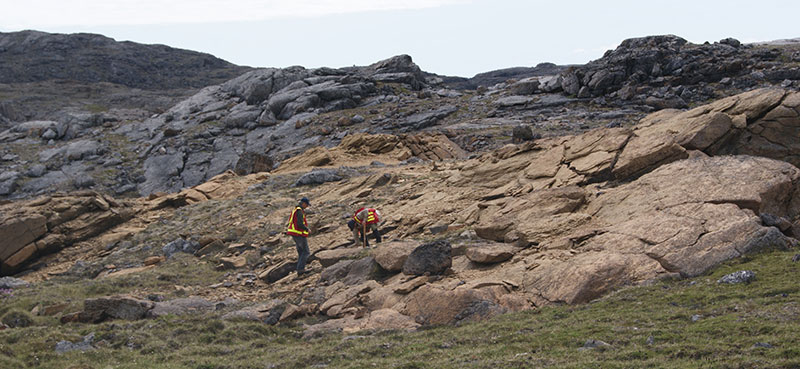
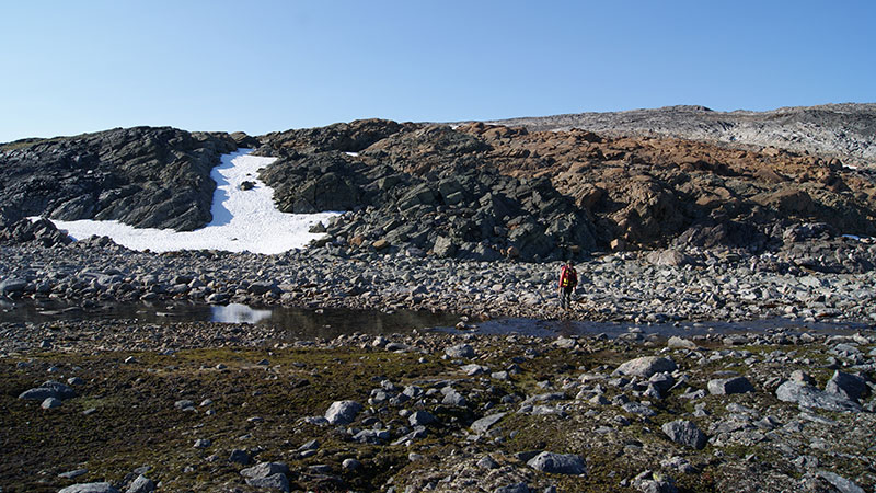
Writing an assessment report
Assessment reports and simplified reports should include clear, detailed information on the following:
- what work was done on the mineral claims or prospecting permits
- how the work was done
- results obtained from the work
- what those results demonstrate about the mineral claims and/or prospecting permits
- what those results suggest for future work, if any, on those mineral claims or prospecting permits
An assessment report must include:
- work that was done on a property or project over a period of not more than 12 consecutive months, and submitted within 4 years of completion
- The first report of work submitted for a project may cover work done over up to two calendar years (24 consecutive months) before submission
- a description of the work done and results that were obtained from the work
- an interpretation of those results
- conclusions and plans for future work
Discussion of previous work done on a property should be limited to a brief summary of 1 to 2 pages. In general, when discussing a property's historical work it is better to provide a concise summary with references that interested readers may access for more complete information than to provide an extensive description of work that was completed in the past.
Hard copy report submission
Hard copies of assessment reports must be bound, and must be typewritten or printed on 8.5"x11" paper. They may not be handwritten. Larger pages such as maps, diagrams, sections or spreadsheets printed on 11"x17" paper are acceptable provided 1 full edge is securely bound into the report and the page is folded to fit.
Large-format maps or figures which have not been bound into the report must be folded and placed in pockets, envelopes, plastic sleeves, or other suitable holders which are bound into the report. Loose maps are not acceptable. Hard copy reports are scanned for digital archiving, and the available hardware is only able to scan documents up to 110 cm (44 inches) wide. As such, printed maps are requested to be no wider than 110 cm (44 inches).
All the text, figures and tables in a report must be legible. This includes items such as:
- sample numbers
- structural symbols on maps
- data contained in assay certificates
If the reviewing geologist cannot make out information in the report, or if the information will not scan clearly for digital archiving, revised versions of content that is legible will be requested.
The use of 11-point font is recommended for text and a minimum of 6-point font is recommended for the smallest labels in figures or maps. The minimum recommended print resolution setting is 300 dpi for text and 600 dpi for figures. Maps, sections and diagrams inserted as figures should be in colour where appropriate, and at sufficient resolution to ensure legibility. These requirements also apply when submitting reports in electronic format, discussed in the next section.
If storage media such as CDs, DVDs, USB sticks, or external hard drives containing raw data are submitted with hard copy reports, they must be attached to the report in some fashion and not submitted loosely. Each piece of storage media must be labeled with the company name, project name, report date and the number of pieces being submitted, for example 'Disc 1 of 3'. NMR Sch. 2, 3(1)(j)
Electronic format report submission
Under the NMR, assessment reports may be submitted in electronic format. However, the Nunavut MRO is unable to accept assessment reports via email because the secure transfer of confidential report files cannot be guaranteed.
Electronic copies of assessment reports must be submitted in a format that can be read using the Mining Recorder's computer systems. Please submit reports in PDF format on physical storage media, such as CDs, DVDs, USB sticks or external hard drives, labeled with the company name, project name, report date and with the number of pieces being submitted, for example 'Disc 1 of 3'. NMR Sch. 2, 3(1)(j)
PDFs must not be password-protected. Please ensure that the "Security Method" in "Document Properties" is set to "No Security" to enable the insertion of any necessary revisions by the reviewing geologist. Georeferenced PDF documents are acceptable as long as they meet the rest of the requirements set out in Schedule 2 of the NMR.
Content criteria for assessment reports
Title page
Assessment reports must have a title page that includes the following information:
- the project name
- claim names and numbers
- types of work done and the minerals being sought
- for whom the work was done
- who completed the work
- the project's location (using the 4 corner coordinates of its bounding box)
- the dates during which the work was done
- the NTS 1:50 000 map sheet number(s) on which the work took place
This title page must be included on each volume of a report if the report has multiple volumes. NMR Sch. 2, 3(1), 3(2)
If the report covers multiple small parcels of mineral claims, a single bounding box that encompasses all parcels is sufficient to ensure that there is enough space on the title page for all the required information.
Title page – electronic reports
Reports that are submitted in electronic format must also contain the title page information on a paper cover sheet submitted with the storage media containing the report, or as a 'readme' text file on each piece of storage media submitted. NMR Sch. 2, 3(2)(b)(i-ii)
Figures
Figures must be numbered so they can be properly referred to in the text, and must include a caption.
Maps
Maps and sections must also be numbered and include:
- a scale bar
- a geographic reference (north arrow on maps, view direction on sections)
- an indication of coordinate system and unit of measurement
- a coordinate grid
- an appropriate legend that includes all symbols and colours used on the map or section
Maps must be in NAD27, NAD83, NAD83 (CSRS), or WGS84 with the datum and zone number (or projection, if applicable) indicated on each map. NMR Sch. 2, 6(1)-6(3); 9(1)-9(4)
According to the NMR, several specific maps must be included in an assessment report:
- a map that shows the boundaries of each mineral claim on which work is being reported and of any adjacent mineral tenure, including those belonging to other licensees. Each claim belonging to the licensee doing the assessment work must be identified with its claim number NMR Sch. 2, 5(c)(i-iv)
- a map that shows the area worked in relation to territorial boundaries, including communities and regional infrastructure, such as airstrips, camps, docks, and/or winter roads NMR Sch. 2, 5(b)
- a map of the regional geology of the project area NMR Sch. 2, 5(a)
- one or more maps showing the location of all surface samples, drill holes or other data collection points, with legible identification numbers for each location. Inset maps should be used to display areas with high densities of data points NMR Sch. 2, 5(d)
- one or more maps that shows any grids used to perform work, such as sampling grids or ground geophysics traverse grids. Grid coordinates must be included NMR Sch. 2, 9(2)
- one or more maps that shows any geochemical or geophysical anomalies, if geochemical or geophysical work was done NMR Sch. 2, 5(e)
Reference list
A reference list is required for all works cited in the report text, including any maps and figures. The Canadian Journal of Earth Sciences (PDF) style is recommended for reference lists. When referencing assessment reports, the following format is suggested:
Author last name, initial(s). 2014. Assessment report on the Shiny Objects project. CIRNAC Assessment Report #00001. Report prepared by J. Geologist for Raven Resources Ltd.
Full bibliographies are not required for assessment reports. Please only include sources in the reference list that are directly referenced in the report. NMR Sch. 2, 4(e)
Appendices
Several appendices are required in assessment reports:
- a list or table of abbreviations and short forms used in the report or the appendices (e.g. in drill logs or sample descriptions). This list must include all abbreviations used to describe rocks, features, mineralogy, geology and landforms. NMR Sch. 2, 4(f)
- the report author's Statement of Qualifications. Only one statement of qualifications signed by a NAPEG-registered qualified person is required for a report. NMR 42(4)(b)
- the report's Statement of Expenditures. NMR 42(5)
The statement of expenditures should set out costs incurred in performing the work, in sufficient detail that they can be assessed by the reviewing geologist. It should include details on salaries paid to and a list of the types of workers conducting the work, their rates of pay, and the time spent working on the project. Please do not provide employee names or home addresses. A link to a template for the Statement of Expenditures is provided above in the section on Submitting an Assessment Report.
If work on an exploration program was undertaken by contractors, for example a geophysical survey, any contractors' reports must also be submitted, and must include copies of any deliverables provided to the claim owner by the contractor, for example large format maps, raw data, and analytical certificates as applicable. NMR Sch. 2, 16(1)(d)
The Statement of Qualifications should indicate the Qualified Person's professional affiliation, their place of employment and its location, and a statement declaring that they are an author of the report (as a report may have multiple authors). It must be signed and stamped with the qualified person's official stamp or seal. NMR 42(4)(b)
A suggested template for the Statement of Qualifications is as follows:
I, (geologist's name), indicate the following:
- I am a Professional Geologist/Geoscientist affiliated with the Northwest Territories and Nunavut Association of Professional Engineers and Geoscientists (NAPEG).
- I am employed by [company name], headquartered in [name of city or town].
- I am an author of this report on the [project name] project.
- I supervised the work being reported on in this report.
- This report is complete and correct to the best of my knowledge.
The statement must then be signed by the Professional Geoscientist and indicate the municipality and province or territory where signing occurred. The statement must also be stamped with a NAPEG stamp.
Submitting revisions to your report
If the reviewing geologist determines that revisions to your report are necessary for compliance with the NMR, they will provide the requirements in their letter of review.
Requirements for specific types of report
Geological report requirements
Geological work reports require a detailed description of the property's geology, including rock types, structural features, and areas of mineralization. The report must include a discussion of all results obtained from the geological work and their relevance to future work on the property. Any geological maps produced from mapping programs must be included.
If prospecting took place, a table of samples along with descriptions and coordinates should be included as well as a map showing traverse locations and a map showing the locations of samples taken. If drilling took place, a map showing the location of each drill hole is required, as well as drill sections and logs. The intervals of core sampled for assay and results of assays on those samples must be identified on each drill section. The location of any stored drill core must also be indicated. NMR, Sch. 2, s 12(a-d), 13(a-e), 14(a-d)
If data compilation or literature review work is done, for example reprocessing of historical geophysical data from work done by a previous operator, the costs associated with that work may be acceptable as an expenditure provided that it leads to a new geological interpretation, a new deposit model, or another similar deliverable. Compilation work whose related expenditures are presented without any new results is not considered acceptable "work" under the NMR.
Geochemical report requirements
The type of geochemical survey performed for example till sampling, grab sampling, stream sediment sampling, lake bed sampling, etc. must be described, including details of the analytical process or processes used on the samples collected. A map showing sample locations is required, as well as any geochemical anomaly maps or profiles produced. Please also include the raw data used to produce these maps and profiles. Cut-off grades should be indicated wherever relevant. A discussion of the survey's results is also required. NMR, Sch. 2, s 15(a-i)
If the geochemical work was done by a contractor, any report produced by that contractor, as well as the data collected and any other hard copy or digital products produced such as maps, profiles, or other products must be submitted with the assessment report. NMR, Sch. 2, s 4(u)
Assay certificates and similar analytical reports must be signed by a qualified person from the accredited lab that performed the analysis and must be submitted with the assessment report. The qualified person's signature must be present on a cover letter that indicates their accreditation and stamp, and/or on each assay certificate.
Geophysical or remote sensing report requirements
The type of geophysical survey performed must be described. For example:
- airborne magnetic
- ground magnetic
- gravity survey
- hyperspectral remote sensing
A map showing flight or traverse lines and their direction is also required, as are any maps, tracings, or geophysical profiles produced. The raw data used to produce these maps and profiles must also be included. If underground geophysical surveys were performed, the location and orientation of the survey with relation to underground workings must be described. A discussion of the survey's results as it relates to the project is also required. NMR, Sch. 2, s 16(1-5)
If the geophysical work was done by a contractor, any report produced by that contractor, as well as the data collected and any other products produced, either hard copy or digital (e.g. maps, profiles, etc.), must be submitted. NMR, Sch. 2, s 4(u)
If 3D modeling data is submitted it should be accompanied by viewing software that allows the data to be examined.
When submitting reports that include remote sensing work, please include the reference information and metadata for any images used in the report, including time and date taken, and the company from which the images were purchased.
In order for the reviewing geologist to determine assessment credit for work involving the purchase of remote sensing data, without requiring a company to break the terms of its end-user licence agreement (EULA) with a remote sensing data provider, the following must be submitted:
- any 'deliverables' produced from the raw satellite images, such as surficial geology maps, structural maps, or similar, as we would for other types of work such as geophysics.
- a copy of the EULA between the company and the data provider to confirm the terms of the agreement. This will remain confidential and will not be included in the report when it is eventually released to the public. The purchase and analysis of remotely-sensed data is not eligible for assessment credit unless the results of its analysis have been evaluated using methods listed in the definition of "work" NMR 1 (1) "work" (a) (i-vii).The assessment report should clearly set out the findings of the remote sensing data analysis, and how the work done has confirmed or refuted the findings. For example, if you use remote sensing data to identify gossanous outcrops, these findings can be evaluated by visiting the identified locations, confirming which identifications of outcrops as gossanous are accurate, and then sampling the outcrops for geochemical analysis.
Completing the necessary ground truthing of remote sensing work for its accuracy or validity in the field may be difficult to accomplish in the 12-month period in which work on mineral claims can be reported. Therefore, subject to NMR 42 (2), costs of work related to remote sensing, such as imagery purchases or hiring contractors to process data and provide deliverables, may be included in the report in which the activities to ground truth the deliverables are submitted.
Environmental baseline study requirements
Environmental baseline studies are accepted as part of assessment work in Nunavut, provided they meet the same criteria that other types of report must meet, and as long as they are performed in conjunction with other types of assessment work on the same mineral claims. In other words, a baseline study will not be accepted as a cost of work if it is the only type of work being reported on a particular claim during a particular reporting period. These studies must take place as components of a larger field program. Expenses incurred in performing environmental baseline studies that exceed 10% of the total cost of geological work in a report will be excluded as a cost of work. NMR s 1(1)(c), definition of 'work'; NMR Sch. 2, s 4(t)
Archaeological Studies
When submitting archaeological studies as environmental baseline work, the report must include a description of the work done but exclude any reference to the location(s) of archaeological sites. This is intended to avoid any conflict between the confidentiality provisions of the Nunavut Archaeological and Palaeontological Sites Regulations and NMR s 11(2).
Criteria for simplified reports
Simplified reports can be submitted when the cost of work for a report totals less than $20,000, and when only excavation, sampling or the examination of outcrops and surficial deposits, or any combination of them, were performed. NMR S.42 (1), (42 (4), Part 2 of Sch. 2, s 2-11, 17(a-c)
More information on the preparation of simplified reports is available at this link: Simplified Report: a guide for Nunavut prospectors.